Property Record
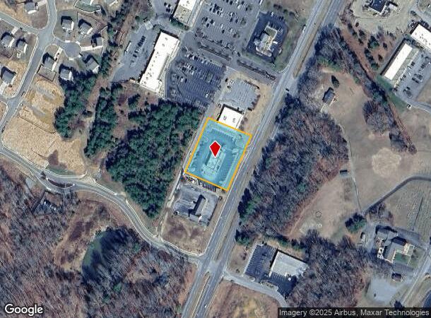
4921 Richmond Tappahannock Hwy, Aylett, VA 23009

NEARBY LISTINGS FOR SALE OR LEASE
Property Detail
4921 Richmond Tappahannock Hwy
28 3 6
LOT 6
Commercialnec
King William
X
Virginia
51101C0135E
6
2025
1.15 AC
2025
King William County
950101
Richmond VA
3,760 SF
Richmond, VA
DEMOGRAPHICS near 4921 Richmond Tappahannock Hwy
1 Mile
3 Mile
5 Mile
2024 Total Population
1,358
6,638
8,742
2029 Population
1,525
7,458
9,792
Pop Growth 2024-2029
+ 12.30%
+ 12.35%
+ 12.01%
Average Age
39
39
40
2024 Total Households
518
2,544
3,358
HH Growth 2024-2029
+ 11.97%
+ 12.07%
+ 11.70%
Median Household Inc
$78,241
$79,415
$79,824
Avg Household Size
2.60
2.60
2.60
2024 Avg HH Vehicles
3.00
3.00
3.00
Median Home Value
$240,173
$238,684
$240,558
Median Year Built
2000
1999
1998
Nearby Places
- Restaurants
- Banks
- Shops
- Fitness
- Groceries
PUBLIC TRANSPORTATION
AIRPORT
Richmond International
DRIVE
WALK
Distance
Richmond International
39 min
25.2 mi
Freight Ports
Virginia Port Authority - Richmond
DRIVE
WALK
Distance
Virginia Port Authority - Richmond
46 min
30.0 mi
SALE & LEASE HISTORY
LISTING DATE
SALE/LEASE

Nov 13, 2018
For Lease
Nearby Properties
Address
Land Use
TOTAL SIZE
Lot Size
Zoning
Address
Land Use
TOTAL SIZE
Lot Size
Zoning
47.44 AC
M
Address
Land Use
TOTAL SIZE
Lot Size
Zoning
51,961 SF
17.87 AC
R-1
Address
Land Use
TOTAL SIZE
Lot Size
Zoning
2,304 SF
4.50 AC
R-1
Address
Land Use
TOTAL SIZE
Lot Size
Zoning
51,702 SF
6.35 AC
B-1
Address
Land Use
TOTAL SIZE
Lot Size
Zoning
2,112 SF
160.40 AC
R-1
Address
Land Use
TOTAL SIZE
Lot Size
Zoning
99,172 SF
10.75 AC
M
Address
Land Use
TOTAL SIZE
Lot Size
Zoning
5,400 SF
5.73 AC
B-2
Address
Land Use
TOTAL SIZE
Lot Size
Zoning
19,177 SF
1.76 AC
B-1
Address
Land Use
TOTAL SIZE
Lot Size
Zoning
9,000 SF
9.64 AC
B-1
Address
Land Use
TOTAL SIZE
Lot Size
Zoning
17,206 SF
8.72 AC
B-1
Address
Land Use
TOTAL SIZE
Lot Size
Zoning
4,091 SF
41.48 AC
R-1
Address
Land Use
TOTAL SIZE
Lot Size
Zoning
3,151 SF
1.74 AC
B-1
Address
Land Use
TOTAL SIZE
Lot Size
Zoning
33,851 SF
2.99 AC
M
Address
Land Use
TOTAL SIZE
Lot Size
Zoning
2,188 SF
2.28 AC
B-1
Address
Land Use
TOTAL SIZE
Lot Size
Zoning
2,854 SF
458.63 AC
A-C
Address
Land Use
TOTAL SIZE
Lot Size
Zoning
4,350 SF
101.60 AC
M
Address
Land Use
TOTAL SIZE
Lot Size
Zoning
3,445 SF
167.15 AC
A-C
Address
Land Use
TOTAL SIZE
Lot Size
Zoning
10,474 SF
1.55 AC
B-2
Address
Land Use
TOTAL SIZE
Lot Size
Zoning
1.24 AC
B-1
Address
Land Use
TOTAL SIZE
Lot Size
Zoning
6,889 SF
1.15 AC
B-1
Address
Land Use
TOTAL SIZE
Lot Size
Zoning
5,565 SF
9 AC
R-1
Address
Land Use
TOTAL SIZE
Lot Size
Zoning
385.10 AC
A-C
Address
Land Use
TOTAL SIZE
Lot Size
Zoning
5,564 SF
1.04 AC
B-2
Address
Land Use
TOTAL SIZE
Lot Size
Zoning
300 AC
A-C
Address
Land Use
TOTAL SIZE
Lot Size
Zoning
20,172 SF
3 AC
B-2
Address
Land Use
TOTAL SIZE
Lot Size
Zoning
4,478 SF
2.02 AC
B-1
Address
Land Use
TOTAL SIZE
Lot Size
Zoning
5,362 SF
19 AC
A-C
Address
Land Use
TOTAL SIZE
Lot Size
Zoning
3.05 AC
B-1
The World's #1 Commercial Real Estate Marketplace
Connect with us
© 2025 CoStar Group
The information above has been obtained from sources believed reliable. While we do not doubt its accuracy we have not verified it and make no guarantee, warranty or representation about it. It is your responsibility to independently confirm its accuracy and completeness. Any projections, opinions, assumptions, or estimates used are for example only and do not represent the current or future performance of the property. The value of this transaction to you depends on tax and other factors which should be evaluated by your tax, financial, and legal advisors. You and your advisors should conduct a careful, independent investigation of the property to determine to your satisfaction the suitability of the property for your needs.